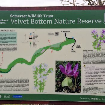
Velvet Bottom Nature Reserve
Velvet Bottom Nature Reserve is one of three Somerset Wildlife Trust nature reserves make up the Cheddar Complex, the other two are Black Rock and Long Wood.
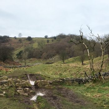
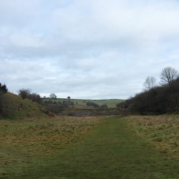
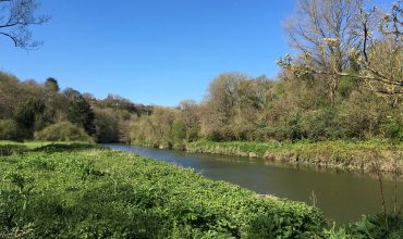
Rich in history, this long and narrow nature reserve lies on the floor of a dry river valley used for lead mining, hence the unusual flat and then dippy landscape that now exists. Lead has been mined here since before the Roman times until the Victorian age, leaving behind this unconventional nature reserve of flat, grassy tiered areas, which are the remains of dams and settling beds used in the mining process.
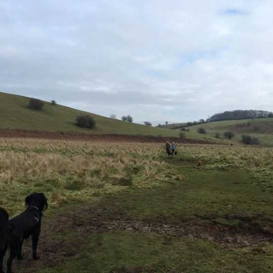
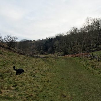
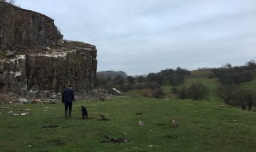
We walked through Black Rock Nature Reserve, which is a lovely walk (wear wellies in the winter, it can be slippery with all the mud!) Seeing signs for Velvet Bottom Nature Reserve, opposite the cliff face, we entered the 17 hectare (42 acre) site. There are usually sheep here in summer, but luckily in winter, there were none at all, meaning Bella could run around off the lead and bounce around happily.
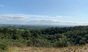
The nature reserve is mostly rough grassland with small areas of trees and scrub, as far as we could see, the area has been fenced off, so we didn’t worry too much about Bella bounding off into the hills without us. Once we walked the length of the nature reserve, we turned back to walk back to Black Rock Nature Reserve. If you want a longer walk, you can walk in a circular route around Long Wood Nature Reserve or walk 2.7km to Cheddar via the Gorge Walk.
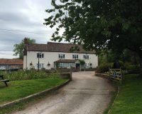
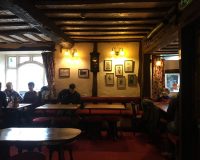
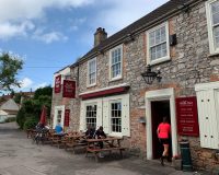
After you have finished your walk you can pop over to Cheddar, where most of the cafes and pubs are really dog friendly, such as Lion Rock Tea Room (fab for afternoon tea) or The White Hart pub. We would highly recommend Cheddar Paws Bakery, a dog bakery, where your pup can treat themselves to a pupcake, pink doughnut or biscuit. We took Bella there and she loved it!
To get to Velvet Bottom Nature Reserve, you can access it through two ways:
• The most direct route is to travel towards The Charterhouse Centre (BS40 7XR), which is very close to the nature reserve. The Charterhouse Centre sits on a corner of a crossroads, you need to drive down the unmarked lane to the side of The Charterhouse Centre (look for the cycle route sign). Drive down here for a couple of minutes and you will see a small area to park surrounded by grassy mounds.
• The other way to get to the nature reserve is to walk through Black Rock Nature Reserve. The nearest postcode is BA5 3BT. If driving out from Cheddar, drive uphill on Cliff Road (B3135), after a few minutes you will see an area for cars to park on your left with a fence, information sign and gate in front. Some cars can park here, if you have trouble parking, a lot of people park on the verge, but we would recommend getting there early.
View this post on Instagram
The history
‘As you walk through the reserve you will encounter a series of dams and levels left over from the lead mining operations. They were designed to help prevent the contamination of the local water supply by allowing the harmful lead sediments to settle out of the water. The remaining high lead level reduces the species diversity on these levels. The bracken growing at the edge of the level areas contains the unusual plant, meadow saffron. In September the leaves of the plant die back leaving only the pink crocus like flowers on display. The plant contains a poison called Colchicine.
Below the small woodland at the northern edge of the reserve are the remains of the buildings used to smelt the lead ore, it is difficult to imagine the bleak industrial landscape that would have existed at this spot when the lead works were in operation. There is an extensive badger sett in this area and you may be able to spot their well worn paths leading through the grassland to their foraging grounds.
The areas of bare ground that the path crosses are mounds of lead slag, the waste material left over from the smelting process. It takes a long time for plants to colonise these inhospitable areas. A specialised community of plants including spring sandwort, alpine pennycress & bladder campion are able to tolerate the difficult conditions and gain a foothold. These areas of bare ground and the nearby dry-stone walls are often good places to see adders and common lizards as they bask on the warm rocks before heading off to hunt in the grasslands.
The rows of shallow circular depressions just visible in the grassland below the path are buddle pits which were used to clean and separate out the heavy lead ore from the crushed limestone rock.’
Address
Velvet Bottom Nature ReserveBlagdon
Bristol
BS40 7XR
Parking
Limited parking, the nearest postcode for Velvet Bottom is BS40 7XR (ST 50255550) or park at Black Rock (nearest postcode is BA5 3BT) to walk through Black Rock Nature Reserve to Velvet Bottom Nature ReservePaws for thought
Sheep in fields at certain times of the year, keep your dog under control or on a lead. Adders have been reported in the field.Pawfect partner
Leave a comment...
As this is a community website, please keep your comments helpful and positive, thanks!